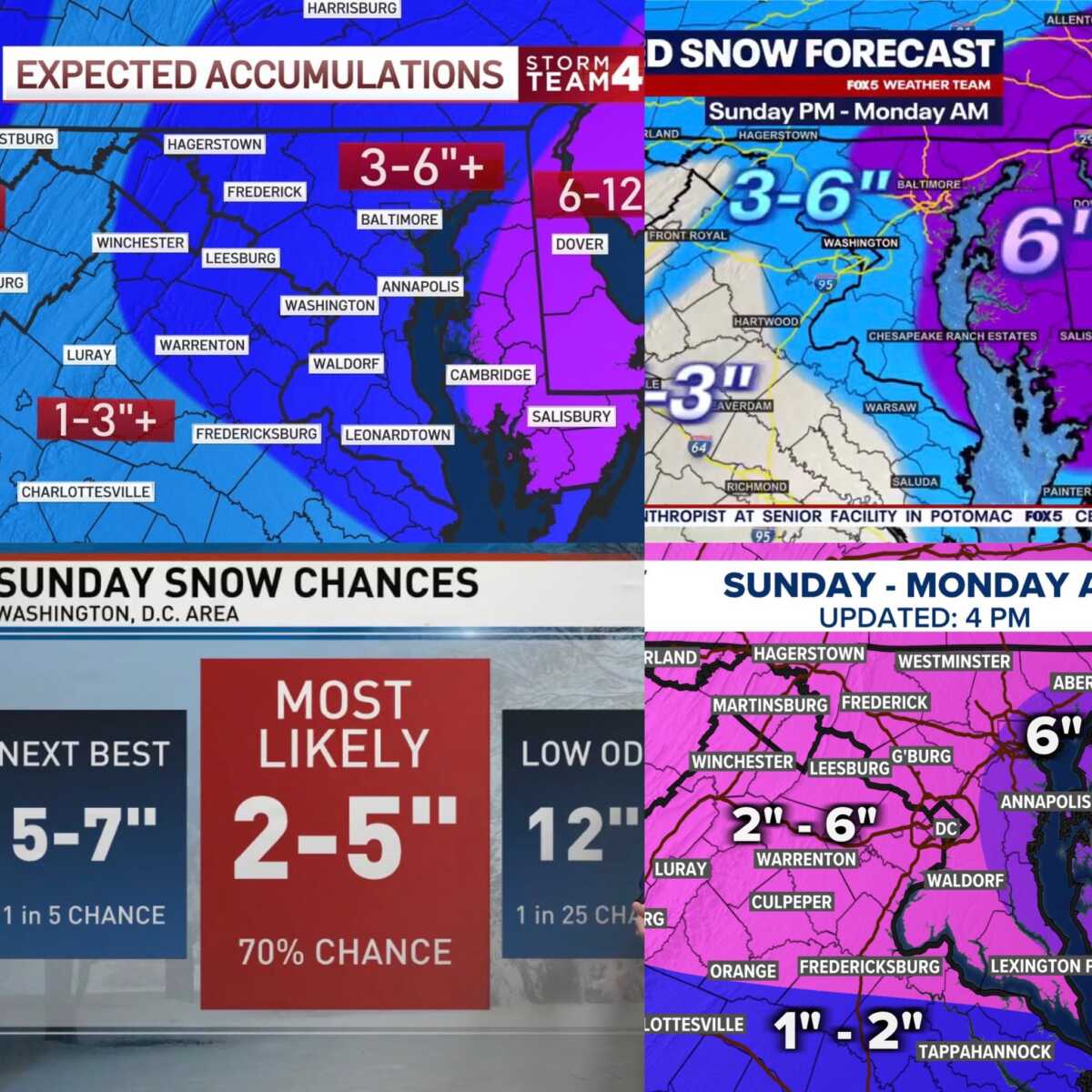
The four major local television networks have all released updated snowfall maps for Sunday into Monday, and they are largely in agreement on the overall setup and expected totals across the region.
NBC4’s latest map shows much of the immediate DC metro area in the 3 to 6 inch range, with higher amounts possible in areas north and west of the city. FOX5’s forecast closely mirrors that outlook, also placing large portions of the region in the 3 to 6 inch zone with eastern Howard County in the 6”+ range.
WUSA9’s map paints a similarly broad picture, showing most of the area falling within a 2 to 6 inch range. ABC7 has been taking a different approach this winter, opting not to release a traditional snowfall map. Instead, the station is using probability-based categories. Under that framework, much of the DC metro area falls into the “most likely” range of 2 to 5 inches, which lines up well with the totals shown by the other networks.
The growing consensus among the major networks comes as winter weather alerts are now in effect across the region. A Winter Storm Warning covers parts of central and north central Maryland (including NW Montgomery County), northern and northwest Virginia, and the eastern panhandle of West Virginia, where higher totals are expected, especially at elevations above 1000 feet. A Winter Weather Advisory is in place for Washington, DC and surrounding areas (including C/SE MoCo), where slightly lower but still impactful snowfall is anticipated.
First Appeared on
Source link


Leave feedback about this