CHICAGO (WLS) — Thunderstorms are expected to move through the Chicago area Sunday before switching over to snow overnight into Monday morning.
A round of thunderstorms is expected to move through between 9 a.m. and noon, with the storms expected to weaken as it moves into the city, ABC7 Accuweather Meteorologist Jaisol Martinez said.
Another round of storms is expected to begin moving in from 4-9 p.m., with the main concern being damaging wind gusts.
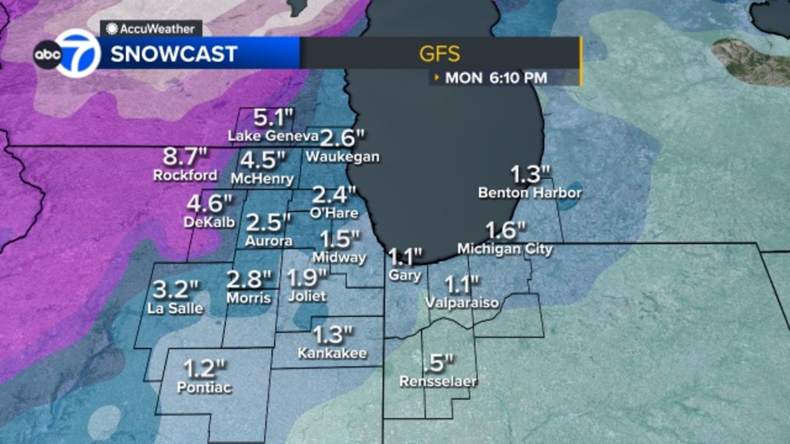
A third round of storms will move in starting at about 1 a.m. Monday, with snow falling through the morning commute until about 10 a.m.
About one to four inches of snow is possible from the snow showers Monday morning.
Most of the Chicago area is at a Level 2 risk for severe weather, with northern and northwestern suburbs at a Level 1 risk.
A Winter Weather Advisory has also been issued for McHenry, Lake (IL), Northern Cook, DeKalb, DuPage, Kane, Kendall, and LaSalle counties from 10 p.m. Sunday through noon Monday.
A High Wind Warning is in effect for Kankakee County and Northwest Indiana from 10 a.m. until 9 p.m. for wind gusts up to 60 mph.
Cook County Radar DuPage County Radar Will County Radar Lake County Radar (IL) Kane County Radar Northwest Indiana Radar
Copyright © 2026 WLS-TV. All Rights Reserved.
First Appeared on
Source link


Leave feedback about this