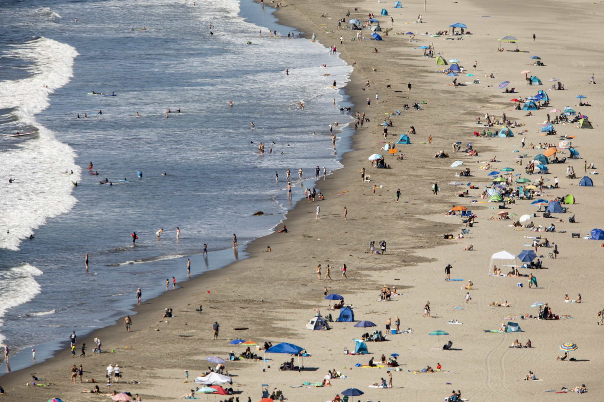
“When it’s warm, San Francisco becomes this magical place where everyone is outside and enjoying it, and it’s really nice to go to the beach those days,” said Nina Atkind, manager of the San Francisco chapter of the Surfrider Foundation.
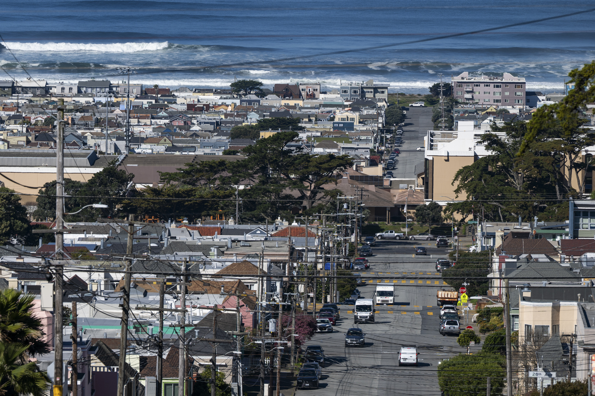
And crowds aren’t your only beach day challenge. As San Franciscans know, it’s not always sunny or warm on the city’s west side when inland neighborhoods are sweltering. San Francisco’s multiple microclimates mean that while the Mission District and Dolores Park might be steamy, the Sunset or Richmond Neighborhoods could be inundated with Karl the Fog, our beloved marine layer.
If you’re among those who are eager for a beach day, we’ve got you covered. Read on for our expert-approved tips as we let you in on our decision-making process when we want to sink our feet into the sand.
1. Decide which beach you want to visit
If you’re hoping to soak up some sun during the heat wave, deciding which beach location to go to is the hardest decision you will have to make.
Firstly, consider: What kind of experience do you want, and what vibe are you looking for? The Bay Area offers it all — family-friendly parks by the sea, dog-friendly spaces, sprawling cliff-lined swaths of sand and even nude beaches.
In the North Bay, check out spots like Stinson Beach, China Beach, Rodeo Beach or even Heart’s Desire on Tomales Bay.
And don’t forget about the Peninsula, with its abundance of options up and down the coastline from San Francisco’s Ocean Beach to Fort Funston, Pacifica, Montara, Half Moon Bay and beyond.
But Scott Havard, a lifeguard at Angel Island who created a website on safe swimming data in the San Francisco Bay, said you don’t have to go all the way to the coast to get a great beach experience. In fact, he recommends spending a day soaking up the sun at any of the East Bay’s shorelines like Keller Beach Park in Richmond, Crown Beach in Alameda, the Berkeley Marina — or even his “home” beaches on Angel Island, accessible by ferry.
“If they don’t want to have to cross the bridge and they’re in the East Bay, just try to try out some of the regional shorelines and the Bay because they’re really gorgeous,” Havard said.
And don’t be deterred from swimming in the San Francisco Bay itself, he said. Havard’s site pulls water quality information from sources all around the Bay Area, including the San Francisco Public Utilities Commission’s Beach Water Quality Survey, where you can check the daily status of the area you’re headed to.
“A lot of the Bay Area communities do a really, really good job of making sure that the Bay stays clean,” he said. “And the rule of thumb for 90% of the time, maybe even 99% of time, is: ‘just don’t swim after a big rain’” — for risk you’ll be swimming with sewage.
2: Research the weather forecast (and change course on decision 1 if need be)
After you’ve got your beach in mind, your next step is the weather forecast. This is as easy as typing “weather” and the “beach name” into a search engine like Google, or your phone’s weather app or visiting the National Weather Service Bay Area office’s website for a more detailed breakdown of the regional weather. If you want to get really nerdy, read the Forecast Discussion that Bay Area meteorologists update several times a day.
But you’ll need to go beyond basic temperatures and also look into factors like wind, the marine layer and when those temperatures may turn cooler during the day.
Online tools like Windy can help you understand wind strength at beaches, which is helpful for traditional beachgoers as well as for surfers, kitesurfers, sailors and other extreme sportspeople.
Sylvia Lacock, co-owner of Pacific Open Water Swim Company in San Francisco, said she uses Windfinder to learn how strong the wind will be before she swims in the ocean — or hangs out at the beach.
Lacock’s own yardstick: A wind speed forecast of 5 miles per hour or less usually means “it’s going to be a pretty nice day,” she said.
Atkind said surfers like her use two sources to figure out whether to surf out at Ocean Beach, near her home in the Outer Sunset neighborhood: Ventuksy for wind conditions and Surfline for wave conditions.
The number one thing Atkind is paying attention to is the fog, noting that shifting winds can quickly change the temperature.
“It can be really hot one second, and then five minutes later, a 20-degree drop,” Atkind said. “I often bring a pair of socks, a beanie, a sweater, and maybe a jacket too. It feels crazy in the moment when it’s hot, and then every time — I always need it.”
If anything in the forecast is a major deterrent, then go back to step 1 and look up another beach or a different part of the Bay Area to visit.
3. Scout your chosen beach using webcams
Many of us have had the experience of getting stoked to visit the beach, picking up an artisanal sandwich and some drinks … and then, upon arrival, the shoreline instead proves cold and windy, and the waves look scary.
That’s why truthing the weather with a live webcam of the exact beach or area you want to visit is an important step in deciding what beach to lounge at.
Atkind uses Surfline’s webcams to help her decide if she should head to the beach, but it comes at a pretty penny, requiring a subscription. She said that often friends split the subscription fee.

“I use it to see if it’s foggy or sunny or what 75-degree day I’m missing at the beach,” Atkind said.
The Golden Gate National Parks Conservancy website lists webcams across San Francisco. They are particularly helpful in determining whether the fog bank is moving toward the Golden Gate Bridge.
ALERTCalifornia, a camera network operated by UC San Diego, also offers webcams across the state, including many in the Bay Area, to better understand natural disasters and inform management decisions.
One particularly compelling view is from Mt. Tamalpais, where you can see the Pacific Ocean, San Francisco and all the way down to Pacifica. There’s also a view from Sutro Tower that offers a birds-eye view of San Francisco.
What about webcams pointed at beaches themselves? Luckily, cameras are installed across the state at many beaches, including Pacifica and a slew of others listed publicly online.
And just like the steps above, if something you see in a webcam looks like a reason not to go to a particular beach, go back to step one and find another option.
4. Look up the tides
Checking out the tides is especially important if you’re going to visit a place that’s remote, rocky, or where high tides can cut off access, like San Francisco’s Marshall’s Beach. They’re also essential for understanding if you plan to swim.
As a surfer, Atkind uses Surfline to understand how tides will affect the waves, and she often looks at Tide Alert, a free app that uses a “really cool visual graphic” of the phase of the moon and when high and low tides will occur, as well as wind and temperature data and swell size.
When you get to the beach, Atkind’s last step is to look at the water and follow your gut once you’ve looked into everything above.

And if the tides feel like they are too high or too low for you to visit a specific beach, Lacock suggests people who are nervous about entering the Pacific Ocean or San Francisco Bay visit places like Aquatic Park in San Francisco, Alameda Beach or Crown Beach in the City of Alameda because they offer a more controlled environment.
Also, while temperatures will spike during the heat wave, the Pacific Ocean will remain frigid, warned Lacock.
She recommended taking measures to stay warm to avoid hypothermia.
“People don’t realize until it’s too late to get out of the water and someone might have mild hypothermia,” Lacock said. “Even when it’s warm outside, when you get out of the water, get warmed up quickly and put warm layers on.”
And remember: as well as being cold, the ocean can be highly unpredictable. “Don’t treat the Pacific Ocean like a lake,” Lacock said, especially if you visit spots like Ocean Beach, where rip currents or sneaker waves can catch a person by surprise and tow you out into the sea.
5. Think about the best mode of transportation (knowing parking can suck)
What’s more posh than taking the bus to the beach? But seriously, there’s nothing worse than packing your tote and donning your sunnies only to arrive at a very full parking lot.
Not only can that extra 15-20 minutes spent looking for parking completely kill your carefree mood, but you run the risk of not being able to find parking at all.
Luckily, the Bay Area has more than its fair share of transit-accessible beaches — some of which the ride is nearly as pleasant as the destination itself. We’ve got a few suggestions below:
Take the ferry to Angel Island’s Ayala Cove
Not only is Ayala Cove one of the Bay Area’s best beaches to swim at, but it’s also just a short walk from the ferry terminal at Angel Island, serviced by both San Francisco and Tiburon. The ferry ride itself is a complete joy, and your Clipper card — or even a credit/debit card — works, so you don’t have to worry about buying a ticket in advance.
The beach is in a small cove of the island, where the bay currents aren’t as strong. There are also bathrooms, tables, barbecues and a cafe if you forgot your picnic.
And if you’re seeking some extra adventure and a slightly quieter beach, Havard recommends strolling a couple of miles to Quarry Beach.
First Appeared on
Source link


Leave feedback about this