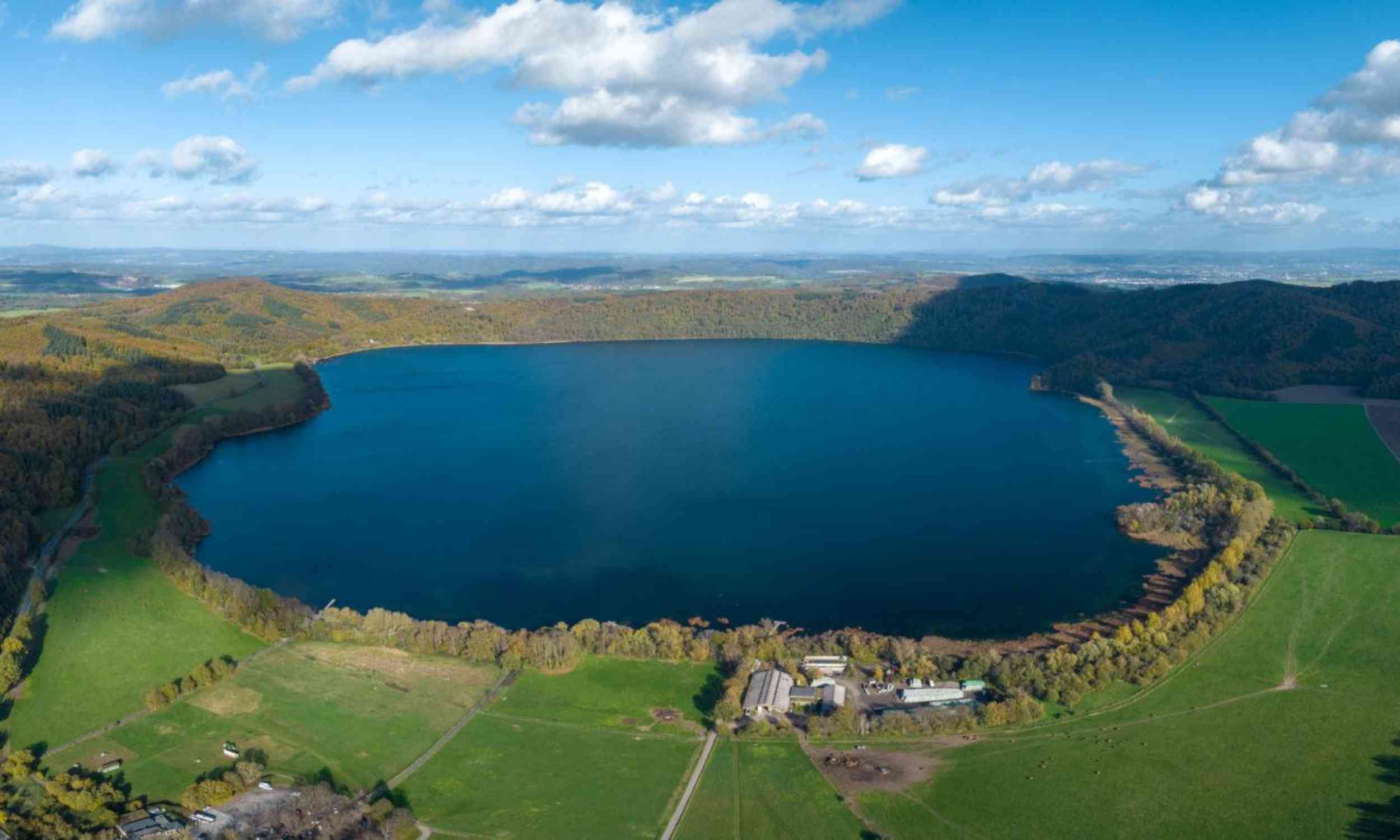
More than 1,000 tiny earthquakes have exposed a deeper, slanted reservoir beneath Germany’s Lake Laach volcano, not the vertical body scientists expected.
That new picture links the lake’s quiet surface to an active underground system that may still be building pressure today.
Beneath Lake Laach
Buried faults between Ochtendung, near Koblenz, and Lake Laach held the evidence, with most tremors lining up in one narrow zone.
Reading those signals, Torsten Dahm at the GFZ Helmholtz Centre for Geosciences (GFZ) mapped a buried system that changed the old picture.
His team found the reservoir tilted toward the Neuwied Basin, a valley on the Rhine, where many small quakes gathered.
Even so, the geometry does not prove an eruption is near, but it points to a living system worth watching more closely.
How they listened
Across the Eifel hills, the team spread more than 500 sensors and tapped a 40-mile (64-kilometer) fiber-optic cable as another ear.
Light moving through that line changed with tiny strains and temperature swings, letting researchers register vibrations ordinary networks would miss.
Station spacing sometimes shrank to about one mile (1.6 kilometers), giving the region its sharpest underground view yet.
Because that net was so dense, tiny structures emerged that older surveys had blurred together badly.
What the quakes show
During one year, researchers logged 1,043 microearthquakes, earthquakes too small for people to feel, mostly 6 to 10 miles (10 to 16 kilometers) down.
Many arrived in short bursts, and several looked so alike that they likely reused the same stressed patch.
Those patterns fit a system nudged by moving fluids, because pressure can weaken rock and let already loaded faults slip.
Near one southern step in the fault zone, though, the sequence looked more like standard aftershocks than a fluid swarm.
Clues to underground magma
Elsewhere beneath the basin, unusual seismic reflections pointed to magmatic fluids, hot gases and liquids released by melt, pooling between rock layers.
“The strength of the reflections indicates that fluids have accumulated in these layers. Whether these are magma or magmatic fluids has not yet been clarified and will be investigated using improved evaluation methods,” Dahm said.
For hazard work, that uncertainty matters, because a pressurized pocket of melt behaves differently from gas or water in cracks.
Clues before this
Lake Laach last erupted 13,006 years ago, and that blast ranks among Europe’s largest late Ice Age eruption.
Since 2013, deeper rumblings 6 to 25 miles (10 to 40 kilometers) below the volcano have suggested fresh material still rises from below the earthquake zone.
Gas studies at nearby mineral springs also found repeated pulses from deep sources, hinting that fluid pathways remained active.
Seen beside those clues, the new earthquake map looks less like a surprise and more like a missing piece.
A reservoir re-drawn
Earlier imaging had already pointed to a cylinder of unusual rock beneath the volcano, reaching roughly 7 miles (11 kilometers) deep.
The newer earthquake catalog added motion to that picture, showing stress changes next to the reservoir rather than around it evenly.
Researchers estimate the active part may sit about 5 to 6 miles (8 to 10 kilometers) down and lean toward the basin.
So the slant could help explain why quakes bunch along one side instead of circling the lake evenly.
Pressure shifts fault motion
From 192 better-resolved events, the team saw the regional stress field rotate near the volcano rather than stay constant.
That pattern fits overpressure, pressure higher than surrounding rock, because swelling material pushes sideways and changes how nearby faults break.
Most quakes along the main fault slipped sideways, while a nearby cluster dropped downward on what may be a hidden basin edge.
A few quakes even pushed upward, a sign the local pressure pattern may differ sharply from the broader region.
Hazards in volcanic fields
The Eifel is not a single-vent volcano, but a spread-out volcanic field with many old vents.
In places like that, the next eruption would not necessarily reopen the last vent or follow the last route.
Sharper maps can guide gas monitoring, earthquake watch lists, and land-use planning where quiet landscapes hide complicated crust.
They also help scientists separate ordinary tectonic earthquakes from signs that molten material or hot fluids are moving.
What remains uncertain
One caution stands out: the model does not prove today’s reservoir is overpressured, only that the earthquake pattern is consistent with that idea.
Pre-existing weak zones in the crust could also steer the quakes, even without a growing pocket of magma.
Sorting between those explanations will require more well-resolved quakes and finer stress tests across smaller slices of rock.
Until then, the strongest claim is not imminent eruption, but a crustal system that remains active in several ways.
New baseline for the Eifel
Germany’s best-known dormant volcano looks less dormant when thousands of tiny quakes, older gas clues, and a tilted reservoir are read together.
For now, the new map changes the baseline: future unrest in the Eifel can be judged against a far sharper picture.
The study is published in Geophysical Journal International.
—–
Like what you read? Subscribe to our newsletter for engaging articles, exclusive content, and the latest updates.
Check us out on EarthSnap, a free app brought to you by Eric Ralls and Earth.com.
—–
First Appeared on
Source link


Leave feedback about this