NEW YORK CITY – New York City is bracing for the first blizzard in more than a decade as remnants of the last major snowfall still remain across the city.
JUMP TO: PROJECTED TOTALS l TIMELINE l COASTAL IMPACTS
MORE: School closings and delays in NY, NJ, CT for Monday, Feb. 23
- Stay connected with FOX LOCAL. For 24/7 winter storm coverage—Download Now.
New York City Mayor Zohran Mamdani declared a state of emergency for the five boroughs, as well as a travel ban, meaning no vehicles are permitted on streets, bridges and highways for the duration of the ban – lasting from 9 p.m. to 12 p.m. Monday.
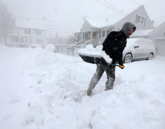
Northeast blizzard
What we know:
A major coastal storm is set to impact the Tri-State area Sunday into Monday, prompting blizzard warnings for New York City, Long Island, New Jersey and coastal Connecticut as forecasters call for heavy snow, strong winds and significant travel disruptions.
FOX Weather LIVE updates
Both New York Gov. Kathy Hochul and New Jersey Gov. Mikie Sherrill declared states of emergencies on Saturday in preparation for the snowstorm.
Winter weather Alerts through Monday (FOX Weather)
By the numbers:
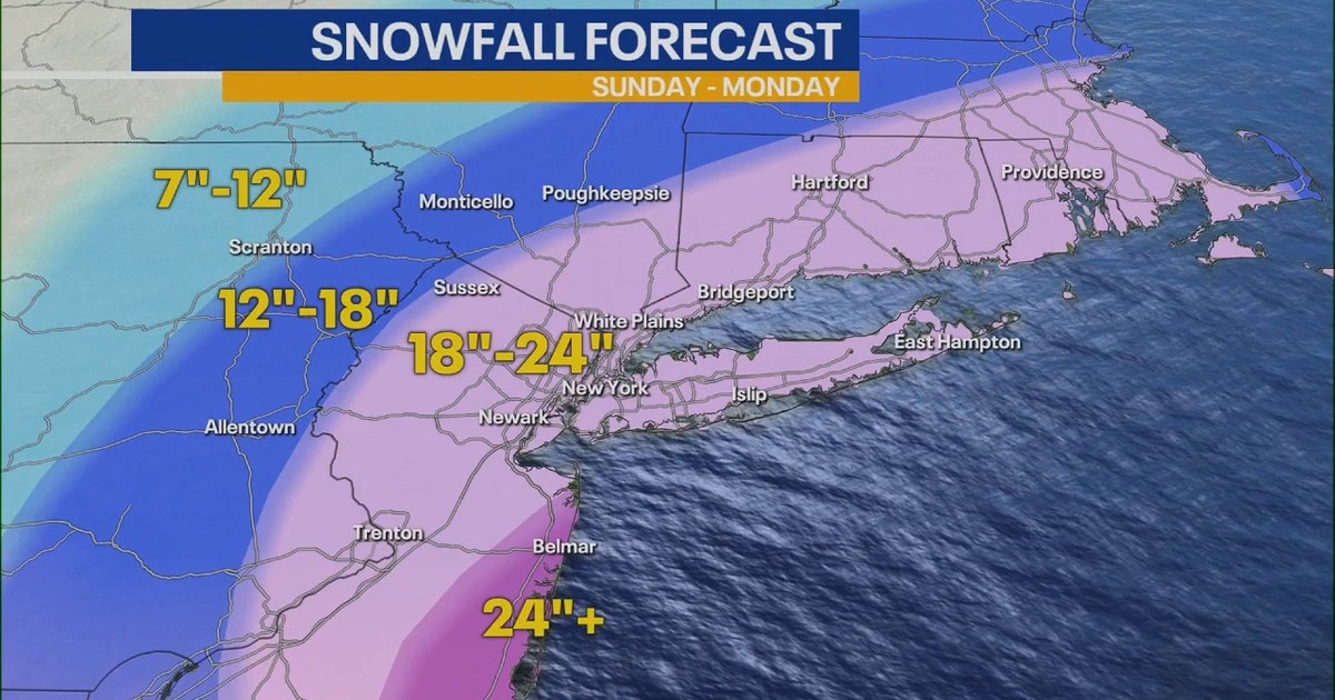
Total accumulations for the New York City area are expected to be between 16 and 24 inches, while parts of New Jersey could see 20–30 inches.
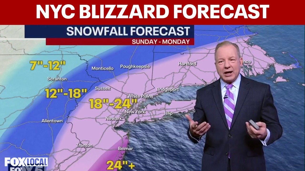
Snowfall total predictions:
- NYC: 20 inches
- North Jersey: 20 inches
- Jersey Shore: 24 to 30 inches
- Long Island: 23 inches
- Connecticut: 17 inches
Forecasters say New York City, Rockland and Westchester counties, all of Long Island and northeastern New Jersey and coastal Connecticut could see between 2 and 3 inches of snow per hour.
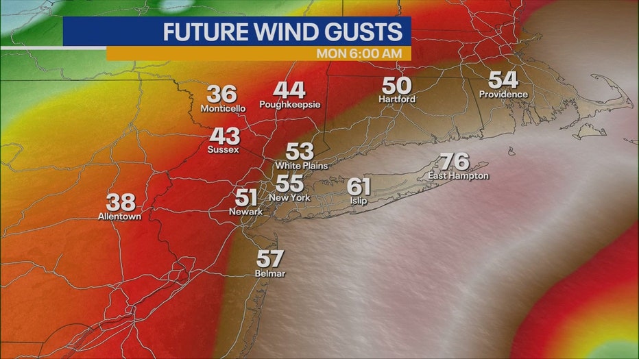
Wind speeds between 30 and 45 mph are expected, with gusts potentially up to 60 mph. Officials say whiteout conditions could lead to “dangerous to impossible travel” from late Sunday through Monday morning.
Timeline:
The storm is expected to start as rain early Sunday morning, before turning into a wintry mix, then snow.
Parts of New Jersey could see snow as early as 10 a.m. Sunday, while New York City will likely see its first flakes around 1 p.m. The heaviest snow is expected from 7 p.m. Sunday to noon on Monday, with the snow tapering off in the afternoon and coming to an end by 6 p.m. Monday.
Dig deeper:
The storm is also expected to bring coastal flooding and hazardous marine conditions, prompting a coastal flood warning for the Jersey Shore:
- Widespread minor to moderate coastal flooding possible Sunday night into Monday morning high tide
- Localized overwash and dune erosion possible along ocean beaches
- Ocean waves could build to 12–16 feet
- Gale to storm-force marine conditions possible
Why you should care:
Forecasters warn travel could become dangerous to impossible, especially Sunday night into Monday morning. Heavy, wet snow combined with strong winds could lead to:
Power outage outlook through Tuesday (FOX Weather)
- Downed tree limbs
- Scattered power outages
- Whiteout conditions
- Coastal flooding in vulnerable areas
Residents are urged to avoid unnecessary travel during peak storm hours and monitor official updates.
Stay ahead of the snow with FOX 5’s expert meteorologists, streaming LIVE on FOX LOCAL. We’re streaming nonstop coverage with the newest forecasts, snow potential, and preparation tips. Download FOX LOCAL for 24/7 weather coverage on your smart TV and mobile devices.
The Source: Information from this article was provided by the National Weather Service.
First Appeared on
Source link


Leave feedback about this